Course and route
Ouse views.
Hook village.
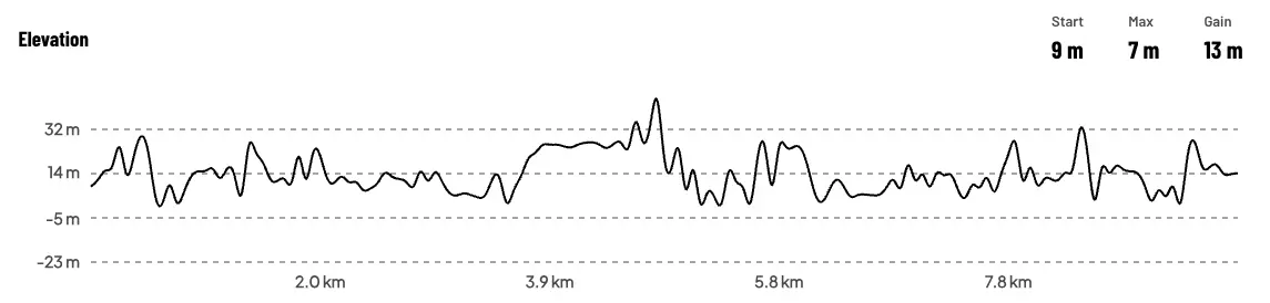
10K / 6.2 miles. The banks of the River Ouse around Goole and Hook: flat, mixed terrain, chip timed. Around 13 metres of climb in total.
In words
Turn by
turn.
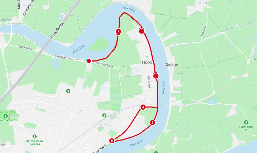
The route starts on the riverbank a short walk from Goole Town Cricket Club and follows the banks of the River Ouse around Goole and Hook, dropping into Hook village and picking the river up again on the far side to follow the big bend back. The final kilometre is along the riverbank with the finish in sight for most of it. Parts of the course use narrow paths and riverbank sections: be considerate of local users, do not cut corners, and follow any taped-off areas or marshal directions. Water stations are at approximately the 3km and 7km marks.
- Keep alert around other runners and path users
- Carry gel wrappers until a bin is available
- No headphones that cover both ears, in line with the race licence
- If you withdraw, report to a marshal
- Water is also available at the finish
Water
Water station 1 at roughly 3km, Water station 2 at roughly 7km, and water at the finish.
Watch it first
The course
on video.
A lap of the course so you know what is coming, and a drone flight over the approach to the cricket club so you know where to go on the morning.
The drone video of the approach is coming. In the meantime, the getting here page has the map and the what3words for the gate.
Elevation
Flat, mostly.
13 metres.
The course starts at about 9 metres above sea level and never climbs more than a few metres at a time. The bumps on the profile are the ramps up onto the flood bank and back down.